The Best Beaches
The best in the world is Emerald Bay. A sundown swim every day is mandatory from the mile-long white powdery beach with its calm turquoise waters shared by Grand Isle Resorts and Sandals. There’s a perfect beach with calm shallow water for young children at the south end of Emerald Bay, past Sandals. For public access, just watch for the “Beach Access” sign on the left before you get to Christine’s gas station in Farmer’s Hill.
Marina Beach
The beach off the Marina across from Grand Isle is one of the best snorkelling spots in Exuma. The water is very clear with no churning of sand by the waves, and there’s a large variety of fish in the reef just offshore. If you want to start cautiously, go in the water between the rise along the marina and Iguana Cay just off shore.
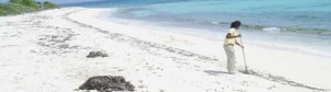
Coco Plum Beach is 7kim north west of Grand Isle towards Rolleville. It is a beautiful white sand family-friendly beach with gentle waves well-known for great shelling and searching for sand dollars during low tide (only take the white and not the grey, still alive, sand dollars). The sand dollars can be found in the sand just three feet off the shore in a very calm bay, so even young children can collect them. Go at low tide. When you arrive, turn right and walk to the sand bar to find the mother lode of sand dollars.
After the green road sign directing you to Barraterre on the left driving north towards Rolleville, the next unmarked right turn is the approx. 2km road to the beach. If you see the sign to ‘run away bay’ you went too far.
Tropic of Cancer Beach, located on Little Exuma, just outside of Williams Town, or its official name, Pelican Beach, is one of the prettiest in the Exuma chain. Snorkeling right off the beautiful beach is fantastic and always an adventure. You’ll know you found it when you see a little hut with benches and the Tropic of Cancer name carved into the ramp down to the beach. The Tropic of Cancer passes right through the beach.
The Lagoon north of Santana’s There is a breathtaking little lagoon two roads north of Santana’s…once you are in there is a no trespassing sign along the way but the beach isn’t private. So beautiful….. It’s just referred to as The Creek.
You can see it on Google Earth:
The coordinates for the turn off at the main road are:
Lat: 23°25’57.23″N
Long: 75°34’56.22″W
The actual river/lagoon is:
Lat: 23°26’14.43″N
Long: 75°35’5.93″W
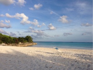
Grand Isle’s Emerald Bay Beach